
Have you ever wondered how websites know your country or city without asking for your address? The answer lies in IP geolocation, a technology that estimates your location through your internet connection. But how does IP geolocation work behind the scenes? It uses information from network providers, public registries, and geographic databases to connect an IP address with an approximate location.
This process helps websites personalize content, detect suspicious activity, and deliver relevant services. However, the results are not always exact. Understanding IP address location, database sources, and network signals will help you discover how this technology works and why accuracy matters.
1. What Is IP Geolocation and How Does It Work?
Imagine opening an online store from your home in California. The website displays prices in US dollars and shows shipping options for your area. It may even recommend nearby stores. How does it know where you are? One possible answer is IP address location. Every device that connects to the internet uses an IP address to communicate with other devices.
Geolocation services examine this address and estimate its geographic origin. They compare it with stored location records and other network information. The result may include a country, state, city, ZIP code, or approximate map coordinates. This process is known as IP location identification. It helps websites understand the likely location of an internet connection without directly accessing the device’s GPS.
However, there is an important difference between an internet connection’s location and your personal location. An IP address does not work like a GPS receiver. It cannot automatically identify your home, apartment, or exact street address. Instead, databases estimate where an internet provider serves the address or where its network operates. For example, a connection may appear in Dallas even when its user lives in a nearby suburb. This happens because the provider may route traffic through a regional gateway. Therefore, the physical location of an IP address usually represents an estimated network area. It does not necessarily identify the person using that connection.
What Information Can IP Geolocation Reveal?
A typical lookup can return several useful details. These include the country, state, city, approximate coordinates, postal information, and time zone. Some databases also identify the network operator, company, or connection type. More advanced services may provide privacy signals that identify possible VPNs, proxies, or hosting providers. The exact information depends on the provider and its database coverage. For example, a lookup might identify an address as belonging to a broadband provider in Chicago. However, that result does not prove the user lives in Chicago. It simply provides an estimate based on available IP location data.
How Does an IP Address Connect to a Physical Location?
The connection begins when an organization receives an address range for its network. An Internet Service Provider (ISP) assigns individual addresses to customers or network equipment. Registries maintain records about which organizations hold larger address ranges.
Geolocation companies use these records as an initial reference. They then compare them with routing information, network measurements, and other reliable signals. This process creates an estimated geographic association. The database may change its result when the provider moves equipment or transfers an address range. Consequently, an address registered in one state might serve customers in another.
IP Geolocation vs GPS: What’s the Difference?
Both technologies help estimate location, but they use different information. GPS relies on satellite signals received by a device. It can provide precise coordinates when the device has a suitable signal. IP-based geolocation examines internet network information instead. It does not need a GPS receiver or direct access to your device’s location settings. This makes it useful for websites that need a general geographic estimate. However, GPS can usually identify a device much more precisely. Internet geolocation is better understood as a network-based estimate rather than a personal tracking system.
Can IP Geolocation Identify Your Exact Physical Address?
No, a normal IP lookup cannot reliably identify your exact home address. It may show your city or a nearby metropolitan area. Sometimes, it displays the location of an ISP gateway instead. Shared networks make this even more complicated. Thousands of customers may use addresses connected to the same regional infrastructure. For this reason, businesses should never treat an IP lookup as proof of someone’s residential address. It is a useful geographic signal, not a household locator.
2. How IP Geolocation Works: Data Sources and Methods
The interesting part happens behind the scenes. A geolocation provider does not simply look at an address and magically discover its location. Instead, it gathers information from several sources and compares their findings. An IP geolocation database may contain registry information, network observations, ISP records, and geographic estimates.
Each source contributes a different piece of the picture. For example, registration records may identify the organization responsible for an address range. Routing information can reveal which network announces that range. Measurement systems can then help estimate where the network operates. Providers combine these signals through IP address mapping to produce a geographic result. The quality of that result depends on the freshness, reliability, and coverage of the underlying information.
No single data source provides a perfect answer. Registry records can show an organization’s mailing address rather than its network location. Routing information reveals network paths but does not automatically identify a user’s city. Latency measurements also have limitations because internet traffic does not always follow the shortest physical route.
Therefore, providers compare several signals before updating their databases. Some also use information from applications and websites that collect location data with appropriate user permission. These different methods support IP location detection across millions of public addresses. Together, they form the foundation of modern geolocation technology.
How IP Geolocation Databases Collect Geographic Information
Geolocation companies build their databases by collecting information from network operators, public registries, measurement systems, and other sources. They organize this information into address ranges and connect each range with geographic attributes. Some providers also receive updates directly from ISPs. Others use User-contributed data from services that can compare an internet address with a device’s known location.
This process is sometimes called Crowdsourced geolocation. For example, a mobile application may have permission to collect GPS coordinates while recording the public IP used during a connection. A provider can use properly collected observations to improve its estimates. It must still account for VPNs, shared networks, and other sources of misleading information.
Regional Internet Registries (RIRs) and IP Allocation Data
Every public internet address belongs to an organized allocation system. A Regional Internet Registry (RIR) manages address resources for a particular part of the world. There are five main registries: ARIN serves the United States, Canada, and parts of the Caribbean; RIPE NCC covers Europe, the Middle East, and Central Asia; APNIC serves the Asia-Pacific region; LACNIC covers Latin America and parts of the Caribbean; and AFRINIC serves Africa.
These organizations maintain registration information about address holders. Their records help geolocation providers understand who controls particular ranges. However, registration data does not always describe where customers actually use those addresses. A company’s headquarters might be in New York while its network equipment serves users across several states.
BGP Routing Tables and WHOIS Records
Another important source is the global routing system. BGP routing tables contain information about how networks announce reachable IP prefixes to other networks. BGP stands for Border Gateway Protocol. It helps internet providers exchange routing information and deliver traffic across different networks. Through BGP routing analysis, researchers can identify which autonomous systems announce particular address ranges.
They can also observe changes in network announcements over time. Meanwhile, WHOIS records and RDAP records provide registration details about address holders and their assigned resources. These records can reveal organizations, contacts, and network registration information. However, neither BGP nor WHOIS automatically provides a verified street-level location. Providers must combine these records with additional evidence.
Active Latency Probes and Network Measurements
Network measurements offer another way to estimate geographic locations. Providers can operate measurement systems in different cities and observe how quickly they reach a target IP address. These systems are called Active latency probes.
They collect Network latency measurements and calculate the Round-trip time (RTT) between different locations and the target network. Suppose a network responds quickly to probes in Atlanta but more slowly to probes in Seattle. That pattern may suggest a location closer to Atlanta. However, this is only an estimate. Routing policies, congestion, peering arrangements, and network equipment can change the results. Therefore, latency measurements work best when combined with registry and infrastructure information.
ISP Network Topology and Infrastructure Mapping
Internet providers operate large networks with routers, gateways, data centers, and regional connection points. These systems form the provider’s ISP network topology. Understanding this structure helps researchers estimate where certain address ranges operate. For example, an ISP may serve customers across several states through regional points of presence. A geolocation provider can study these network connections and compare them with known infrastructure locations. This process is known as ISP infrastructure mapping. It can improve geographic estimates when the provider has reliable network information. Still, an address connected to a regional gateway may represent customers spread across a much larger area.
DNS Records, Crowdsourced Data and Additional Location Signals
Some providers also examine DNS records and other network-related information. Reverse DNS names can sometimes reveal an ISP, regional site, or network role. However, naming practices vary between organizations. A hostname mentioning a city does not guarantee that the address physically operates there. Providers may also use User-contributed data and verified observations from applications. These sources help identify differences between registered and actual deployment locations. Good providers check such signals carefully instead of accepting every observation as accurate. This reduces the risk of incorrect updates caused by VPNs, remote access, or shared connections.
How an IP Geolocation Lookup Produces a Location Result
The final lookup process is usually quick. A website first identifies the visitor’s public IP address. It then sends that address to a database or geolocation API. The provider checks which address range contains the supplied IP. Next, its system retrieves the associated geographic and network information. Depending on the service, the response may include a country code, city, coordinates, ISP, and accuracy radius. The website can then use this information to display regional content or apply security rules. This entire process is called a Geographic IP lookup. It can happen within seconds without requiring the visitor to enter an address manually.
For example, imagine a customer visiting an online store from Austin, Texas. The store receives the customer’s public IP and checks its geolocation provider. The response identifies the United States and estimates a location near Austin. The store may then show US shipping options and local currency. However, if the customer uses a VPN server in New York, the result may point toward New York instead. This example shows why the reported location depends on the network connection. It may not represent the customer’s actual location.
3. How Accurate Is IP Geolocation at Country, Region and City Level?
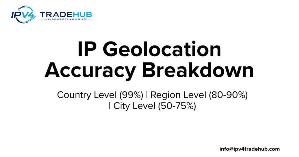
Accuracy depends on how much reliable information a provider has about an address range. Country-level results are generally more dependable than city-level estimates. This happens because internet providers usually assign large address ranges within known national networks. Identifying a country is therefore easier than identifying a particular city.
However, regional and city estimates require more detailed information about network deployment. A provider may identify an American address correctly but place it in the wrong state. Another database might identify the correct metropolitan area but show an outdated ZIP code. These differences explain why IP geolocation accuracy changes between providers and geographic areas. You should always consider the provider’s confidence information before relying on a result.
There is no single accuracy percentage that applies to every IP address. Results depend on the country, connection type, database, and measurement method. MaxMind, for example, provides an accuracy radius alongside geographic coordinates in its GeoIP services. This radius describes an estimated area around the reported point. It does not guarantee that every connection falls inside that area. MaxMind also publishes country-specific comparison information for its city database. You can review its GeoIP accuracy comparison tool to understand how performance differs between locations. The important lesson is simple: a city result is an estimate, not a confirmed physical position.
How Accurate Is IP Geolocation at the Country Level?
Country identification is usually the strongest level of geographic estimation. Large network providers often operate within clearly defined national address systems. Their registration records and routing information can help databases identify the correct country. However, exceptions still exist. International network gateways, VPN servers, and cross-border infrastructure can create misleading results. An American user connecting through a Canadian VPN server may appear to be in Canada. Similarly, a company using an international network may route traffic through another country. Therefore, even country-level results deserve verification when businesses use them for important decisions.
State and Region-Level IP Geolocation Accuracy
State-level identification requires more detailed network information. In the United States, an ISP may serve customers across several states through shared infrastructure. Its regional gateway might sit in one state while customers connect from another. For example, someone living in northern Virginia might receive a location associated with Washington, DC. This result may be geographically close without matching the user’s actual state. Rural areas can present additional challenges because network equipment is often spread across larger distances. Providers with detailed ISP information may produce better estimates. However, regional results should still be treated as approximate.
How Accurate Is IP Geolocation at the City Level?
City-level estimates are useful for many everyday applications. Online stores can use them to suggest nearby services or estimate regional delivery options. Advertisers can also use city information to organize campaigns. However, the reported city may represent an ISP gateway or a nearby metropolitan center. Consider someone living in a smaller town outside Los Angeles. Their connection might appear in Los Angeles because the provider associates that address range with the larger network area. This does not mean the database is completely useless. It means users should understand the difference between a network estimate and a precise location.
ZIP Code and Postal Code Geolocation Accuracy
ZIP code estimates require even more caution. The United States Postal Service uses ZIP codes to organize mail delivery. These codes do not always match city boundaries or simple geographic areas. A database may associate an IP address with a postal code near the estimated network location. That does not prove the customer lives inside that postal zone. Some providers also return postal information only for selected regions. Therefore, businesses should avoid using IP-derived ZIP codes as verified billing or residential addresses. Ask customers to provide their shipping address when exact postal information matters.
Can IP Geolocation Identify an Exact Street Address?
An IP lookup cannot reliably identify an exact street address. The database does not normally contain a verified connection between every public IP and every household. Instead, it stores approximate geographic information for network ranges. A single public address may also serve many people through shared network systems. This makes household-level identification unreliable. If a website claims that a simple IP lookup reveals your exact home address, treat that claim carefully. More precise location information usually requires separate sources, such as user-provided details or device location permissions.
What Makes One IP Geolocation Provider More Accurate Than Another?
Different providers collect different information and update their records on different schedules. One company may have strong relationships with American ISPs. Another may rely more heavily on public registration data and automated measurements. Their databases may also use different methods to estimate accuracy. Some services return an accuracy radius, while others provide a confidence score or fewer details. Coverage matters too. A provider with excellent information about major US cities may perform differently in rural communities. Compare several databases before choosing one for business use.
4. What Factors Affect IP Geolocation Accuracy?
Even a well-maintained database can return an incorrect location. Internet networks change constantly. Providers add new equipment, move customers between gateways, and reassign addresses. Sometimes, an address range changes ownership without receiving an immediate database update. These events create differences between recorded and actual deployment locations. Other factors include mobile connections, VPN services, shared addresses, and satellite internet. Each introduces a different challenge for geographic estimation. Understanding these limitations helps you interpret results correctly. It also explains why IP location accuracy can vary between two devices using the same internet provider.
The connection type often matters more than people expect. A home broadband connection may provide a relatively stable regional estimate. A mobile connection can behave differently because carriers share addresses among many subscribers. VPN users create another problem because websites see the VPN server’s public address. Satellite providers may route traffic through distant gateways. Meanwhile, transferred address blocks can retain outdated geographic information. These situations do not necessarily mean a database has failed. Sometimes, the available network information simply cannot identify a smaller area with confidence.
Dynamic IP Addresses and Frequently Changing Assignments
Many internet providers use dynamic addressing. This means a customer may receive a different public IP address after reconnecting or when the provider changes its network settings. The previous address may then go to another customer. If a geolocation database still associates that address with its former deployment area, the result can become outdated. For example, an address previously used in Ohio might later serve a customer in Pennsylvania. Providers must detect these changes and update their records. Until that happens, the lookup may display the old location.
Mobile Networks and Carrier-Grade NAT (CGNAT)
Mobile networks introduce a major challenge because they often share public addresses among many subscribers. Carrier-Grade NAT (CGNAT) allows a carrier to connect numerous customers through a smaller pool of public IP addresses. This saves address space, especially for large mobile networks. However, it makes geographic identification harder. One public address may represent users spread across several cities. The database might show the carrier’s regional gateway instead of the subscriber’s location. Therefore, a mobile user in San Diego could receive a result associated with another nearby or distant network center. The address alone cannot reliably separate every subscriber.
VPNs, Proxy Servers and Tor Networks
VPNs change the public address that websites see. When you connect through a VPN, your traffic passes through an intermediary server. The destination website usually sees that server’s public IP address rather than your original connection address. As a result, the lookup may identify the VPN server’s country or city. Proxy services and Tor networks can create similar differences. For example, someone sitting in Florida may browse through a VPN endpoint in New York. A website may then display New York as the estimated location. This is one reason businesses use privacy-detection tools alongside geographic information.
Satellite Internet and Remote Ground Stations
Satellite internet can also produce surprising location results. Your device connects through a satellite network that communicates with ground infrastructure. Depending on the provider’s design, traffic may pass through a gateway far from your home. The public IP address can therefore appear near that gateway rather than your actual community. This issue can affect customers in rural parts of the United States. For example, a household in Montana might receive a result associated with a distant network facility. The displayed location reflects the network’s path, not necessarily the user’s position.
IP Address Transfers and BYOIP Deployments
An address transfer can create a mismatch between historical and current locations. Suppose a company acquires an IPv4 range that previously served customers in California. The new owner deploys those addresses in Florida. Geolocation databases may continue showing California because their records still reflect the former deployment. This can affect website access, advertising, and security checks. Bring Your Own IP (BYOIP) deployments can create similar issues when organizations introduce their existing address ranges into cloud or hosting environments. Network operators should update relevant records and notify providers when deployment locations change.
ISP Routing Changes and Legacy IP Allocations
Older address ranges sometimes carry historical location information. Early internet allocations did not always include detailed deployment records. Some organizations also keep registration information that reflects an old headquarters. Meanwhile, ISPs regularly change routing arrangements and regional infrastructure. These changes can make previous geographic estimates less useful. A database may still show an address in a city where the organization once operated. Updating network records and publishing reliable location information helps reduce these errors. Regular monitoring is especially important for organizations that manage large address ranges.
Why Different IP Geolocation Databases Show Different Results
Each provider builds its own geographic dataset. Some rely more heavily on registry information, while others use network measurements and direct operator updates. Their systems may also interpret uncertain evidence differently. One database might show a city with a broad accuracy radius. Another might return a nearby metropolitan area. A third might provide only the country. These differences do not automatically mean one provider is dishonest or broken. They may simply reflect different evidence and confidence levels. Comparing multiple results can help you identify unusual records.
5. What Is Geofeed and How Does RFC 8805 Improve IP Geolocation?
What if the organization that controls an IP range could publish its actual deployment location directly? That is the main idea behind geofeeds. A geofeed is a simple file containing geographic information about specific IP address ranges. Network operators can publish this information so geolocation companies have another source to consider. The Internet Engineering Task Force introduced RFC 8805 to define a standard format for self-published IP geolocation feeds. This gives address holders a practical way to communicate where their networks operate. It is particularly useful after address transfers, network expansions, and major infrastructure changes.
Geofeeds can help reduce outdated location records. However, publishing a file does not force every provider to accept its contents. Each company decides how it discovers, validates, and uses submitted information. Some providers support geofeed-based updates, while others may require separate correction requests. Authentication is another important issue. RFC 8805 defines the basic feed format, while later standards address discovery and optional cryptographic authentication. In particular, RFC 9632 describes methods for finding geofeed data and optionally authenticating it through RPKI. You can read the original standards through the RFC 8805 specification and RFC 9632 specification .
What Is an IP Geofeed?
An IP geofeed is a text file that connects IP prefixes with geographic information. A network operator can use it to describe where particular address ranges are deployed. For example, a company might publish one entry for its California network and another for its Texas network. A provider that consumes the feed can use these entries as additional location evidence. The file is useful because the organization managing the network may understand its deployment better than an outside database company. However, the information should be accurate and maintained whenever the network changes.
How the RFC 8805 Geofeed Standard Works
RFC 8805 defines a standard CSV format for self-published geolocation information. Each record connects an IP prefix with geographic fields. These fields can include a country code, region code, and city name. The standard helps network operators publish information in a predictable structure. However, RFC 8805 does not guarantee that every geolocation provider will discover or accept a feed. Feed discovery and authentication require additional considerations. RFC 9632 later specified how geofeed references can be represented in RPSL records and how optional RPKI authentication can work.
Understanding the Geofeed CSV Format
A geofeed file uses comma-separated values. Each line describes an address range and its geographic location. The following example uses documentation-only addresses rather than real customer network assignments.
csv
192.0.2.0/24,US,US-CA,Los Angeles
198.51.100.0/24,US,US-TX,Austin
203.0.113.0/24,US,US-NY,New York
The first field identifies the IP prefix. The second provides the two-letter country code. The third identifies the region using an ISO subdivision code. The final field contains the city name. These fields help providers understand the intended geographic association. Operators should check the standard’s formatting requirements before publishing a production feed.
How to Publish and Maintain an IP Geofeed File
Publishing a geofeed starts with preparing accurate network records. The operator should confirm that each prefix belongs to the organization and matches its actual deployment. Next, the file needs to be hosted at a stable, publicly accessible location. The operator must then publish a reference through the appropriate registry mechanism supported by the relevant standard. For example, RFC 9632 describes geofeed references in RPSL inetnum objects. Operators should also test the file and keep it available. If a network moves, its geographic records should be updated promptly.
RPKI Validation and Geofeed Authentication
Publishing a location file raises an important question: how can a provider know that the publisher is authorized to describe the address range? RPKI can help answer this question. It provides a system for validating certain internet resource claims through cryptographic certificates. RFC 9632 describes an optional method for signing geofeed files using an RPKI certificate that covers the relevant address ranges. This helps providers verify that the signer controls the required resources. However, authentication does not automatically prove that every city or region entry is factually correct. It verifies authorization, not the real-world accuracy of every location claim.
How Geofeeds Help Correct Incorrect IP Location Records
Geofeeds give network operators a structured way to share deployment information. This can be especially useful when databases contain outdated records after an IP transfer. Instead of relying only on public registry addresses, a provider can consider the operator’s published geographic data. MaxMind documents support for both RFC 8805 and RFC 9632 feeds. IPinfo also accepts geofeeds and one-time correction requests. Their processes show why geofeeds can be valuable for large network operators. You can review the MaxMind correction guidance and IPinfo correction instructions .
Common Geofeed Mistakes Network Operators Should Avoid
A poorly maintained feed can create more confusion than it solves. Operators should check every prefix and confirm that it belongs to the correct network. Country and region codes must follow the required formats. City names should also remain consistent and reflect actual deployment information. Broken hosting links can prevent providers from retrieving the file. Another common mistake is publishing a feed and forgetting to update it after a network move. Regular checks help maintain reliable information. Operators should also understand that each provider may have its own review and adoption process.
6. IP Geolocation Databases and Popular Providers Compared
A geolocation database is the foundation of most IP lookup services. It stores address ranges and connects them with geographic and network information. When someone visits a website, the service checks the visitor’s public IP against these records. It then returns available details such as country, city, coordinates, ISP, and time zone. Some databases also identify hosting providers, VPN services, and proxy networks. However, not every provider offers the same information. Some focus on downloadable databases, while others specialize in APIs and real-time lookup services. Choosing the right provider depends on your application, budget, geographic coverage, and required level of detail.
For businesses in the United States, database selection can affect advertising, fraud checks, website personalization, and regional content delivery. A small website may only need country-level information. A financial platform might need additional privacy and network intelligence. An ISP managing transferred address ranges may need correction tools and geofeed support. You should compare actual features rather than relying on marketing claims. Also check how often each provider updates its records. A detailed database can still produce outdated results if it misses important network changes.
What Is an IP Geolocation Database?
An IP geolocation database organizes public IP ranges and their estimated geographic locations. It may contain country codes, state information, city names, postal codes, coordinates, and network details. Some databases provide downloadable files that businesses can install on their servers. Others offer APIs that return information whenever an application submits an address. The database connects an IP range with a geographic estimate. It does not maintain a verified residential address for every internet user. Its purpose is to provide useful network location information for applications and services.
MaxMind GeoIP2 and GeoLite2
MaxMind is a well-known provider of commercial and free geolocation products. Its GeoIP2 range offers paid databases and web services. GeoLite2 provides a free option for developers who need basic geographic information. Depending on the product, results can include country, subdivision, city, postal information, and an accuracy radius. The radius helps users understand the uncertainty around returned coordinates. MaxMind also provides a correction process for inaccurate records. Network operators can submit geofeeds through its supported processes. You can explore its products at MaxMind’s official website .
IPinfo
IPinfo provides IP intelligence through web APIs and downloadable data products. Its services can return geographic information, network ownership details, and privacy-related signals. Developers often use its APIs to add location information to websites and applications. Businesses can also investigate whether an address belongs to a hosting provider or a possible VPN service. IPinfo accepts correction requests and geofeeds. However, the available information depends on the product and subscription.
IP2Location
IP2Location offers downloadable databases and lookup services. Its products provide different levels of geographic detail. Depending on the database edition, businesses may receive country, region, city, coordinates, ZIP code, and network-related fields. This gives developers flexibility when building location-aware applications. For example, an online store might use its country information for regional content. A security platform might combine geographic details with other network signals. Before choosing an edition, check its supported fields and update schedule.
DB-IP
DB-IP offers free and commercial IP geolocation datasets. Its services can help websites identify the approximate location of visitors. The available information varies by product and subscription. Developers can use its database files or integrate lookup features into applications. A small website may find its free resources useful for basic geographic identification. Larger organizations may need commercial features and more detailed data. Before making a decision, compare its coverage, update frequency, and licensing terms. Visit DB-IP’s official website for current product information.
Google and Cloudflare IP Geolocation
Google and Cloudflare use location-related information in different products and services. Google offers a Geolocation API that can estimate device location using supported signals, including Wi-Fi access points and cell towers. IP-based estimation can also serve as a fallback in certain situations. This should not be confused with a universal public IP geolocation database. Cloudflare provides IP geolocation features through its network services. Website owners can use location-related request information to support regional rules and content decisions. However, the exact data sources and capabilities depend on each product.
How IP Geolocation Providers Collect and Update Their Databases
Providers continuously review information from registries, network operators, measurement systems, and correction requests. Some also process published geofeeds to improve geographic records. Their update schedules differ because each company follows its own collection and review process. A provider may accept a correction today but include it in a later database release. Another may process certain geofeed updates more frequently. MaxMind explains its correction and geofeed procedures in its official data correction guidance . Therefore, businesses should check each provider’s documentation rather than assume all databases update daily or weekly.
How to Choose the Best IP Geolocation Database
The right database depends on what you want to achieve. A small website may need only country and city information. An enterprise security platform may require network ownership, privacy detection, and detailed API responses. Network operators may place greater value on correction support and geofeed adoption. Compare the following features before selecting a provider.
| Comparison factor | What you should check |
|---|---|
| Geographic coverage | Countries, states, cities, and postal information |
| Accuracy details | Accuracy radius or confidence information |
| Update frequency | Database releases and correction processing |
| API support | Request limits, response speed, and documentation |
| Privacy detection | VPN, proxy, hosting, and anonymizer signals |
| Geofeed support | Ability to consume published geofeed files |
| Pricing | Free access, subscriptions, and commercial licensing |
| IPv6 support | Coverage for modern internet address ranges |
A useful approach is to test multiple providers with the same sample addresses. Compare their results with verified network information. This gives you a clearer picture of their strengths. It also helps prevent one database from becoming your only source of truth.
7. Why Is IP Geolocation Important? Common Use Cases
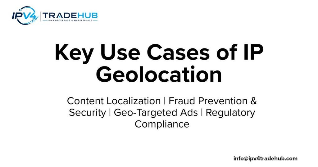
Location information plays a major role in modern online services. Websites use it to show regional content and local prices. Security platforms use it to identify unusual login patterns. Advertising companies use geographic signals to organize campaigns. Content delivery networks use location estimates to help select suitable servers. These applications depend on useful geographic information, but they do not all require the same level of precision. A website displaying a local language may only need country-level information. A financial service may combine location signals with account history and other security checks. Understanding these differences helps businesses use IP location tracking responsibly.
The United States provides many examples of these applications. An online store may display different shipping options for customers in California and Florida. A streaming platform may manage regional content licensing. A financial company may investigate a transaction that appears far from a customer’s normal activity. Meanwhile, a CDN may route visitors toward a nearby network facility. In each case, geographic information supports a business decision. However, it should not become the only source of evidence. IP-based estimates can be wrong, especially when users travel, use VPNs, or connect through shared networks.
Website Personalization and Location-Based Content
Websites often adjust their content according to a visitor’s estimated location. An online store may display prices in US dollars for American visitors. A restaurant directory may show businesses near the visitor’s estimated city. News websites can also highlight regional stories. These changes make websites easier to use because visitors see information that may be more relevant to them. However, location-based personalization should allow users to change their region manually. An incorrect network estimate should not prevent someone from accessing the correct content.
CDN Routing and Website Performance Optimization
A content delivery network stores copies of website files across multiple servers. When someone opens a website, the CDN attempts to deliver content from a suitable server. Geographic information can help it choose an appropriate network location. For example, a visitor in Seattle might receive website images from a West Coast edge server. This can reduce network delays and improve loading times. However, CDNs also consider routing conditions, server availability, and network performance. Geographic distance alone does not always identify the fastest route. Good routing systems combine several signals to deliver content efficiently.
Fraud Detection and Online Transaction Security
Geographic information can help businesses identify unusual account activity. Imagine a customer normally logs in from Chicago. Minutes later, the same account attempts another login through an IP address associated with another country. A security system may treat this as a suspicious event. It can request additional verification before allowing access. However, this does not prove that fraud has occurred. The customer may be traveling or using a VPN. Businesses should combine geographic information with device signals, login history, and transaction behavior. This approach reduces false alarms and improves security decisions.
Regulatory Compliance and Geographic Restrictions
Businesses sometimes need geographic information to support legal and licensing requirements. Streaming platforms may restrict certain content based on regional agreements. Financial companies may also need to consider location-related regulatory obligations. In the United States, state-level rules can differ across industries and services. IP geolocation can provide one useful signal when applying regional controls. However, it cannot independently prove a person’s legal residence or physical presence. Companies should use appropriate verification methods when regulations require stronger evidence. They should also review applicable privacy and data protection requirements.
Digital Advertising and Location-Based Marketing
Advertisers use geographic information to organize campaigns for different regions. A company might promote winter clothing in colder states while advertising summer products elsewhere. Local businesses can also reach audiences within selected metropolitan areas. This makes advertising more relevant and helps companies manage campaign budgets. However, an IP-based city estimate may include people outside the intended advertising area. Advertisers should avoid assuming that every visitor belongs to the exact city shown by a database. Clear targeting rules and other audience signals can improve campaign quality.
Streaming Services and Content Licensing
Streaming companies often manage content availability through regional licensing agreements. A movie available in the United States may not be available in another country. Services can examine a visitor’s public IP to estimate the connection’s country. If the address appears to come from a different region, the platform may apply different content rules. VPNs and proxy servers can complicate this process. The reported server location may not match the viewer’s actual location. Therefore, streaming platforms need to consider both geographic signals and their own licensing policies.
Network Management and IP Reputation Monitoring
Network administrators use geographic information to understand their address ranges. They may investigate unusual traffic, monitor network changes, and review the location of newly acquired IP blocks. Security teams can also combine location data with IP reputation information. For example, repeated login attempts from an address associated with suspicious hosting infrastructure may deserve further review. Still, geographic location alone cannot establish whether an address is dangerous. Administrators should examine traffic patterns, ownership details, and security intelligence before taking action.
IPv4 Transfers and Business Network Operations
Companies that purchase or lease IPv4 addresses need accurate network information. Suppose a business acquires an address block previously used by an organization in New York. The new owner deploys it in Arizona. Some databases may continue associating the range with its previous location. This can create problems with website access, advertising, security systems, and content delivery. Network operators should review registration information and submit appropriate corrections. Publishing a geofeed can also help communicate the new deployment. This is especially important when organizations manage large address ranges across several locations.
8. How to Fix Incorrect IP Geolocation: A Step-by-Step Guide
Seeing the wrong location during an IP lookup can be frustrating. A website may think you are in another state. A streaming service might display the wrong regional library. An online platform could even flag a normal login as unusual. Fortunately, some incorrect records can be investigated and corrected. The first step is to understand which address the website sees. Then you need to identify which database provides the incorrect information. Your ISP, network administrator, or address holder may need to help. The correct solution depends on whether you use a home connection, mobile network, VPN, or transferred address range.
Businesses managing large address blocks should follow a more structured process. They need to verify ownership and confirm where the network actually operates. They may also need to update registry information and publish a geofeed. Individual users usually have fewer options because their public address may be shared or dynamically assigned. MaxMind explains that some corrections cannot be accepted when an address serves users across a wide area. Its GeoIP location correction page provides a useful starting point. Remember that each provider has its own review process and acceptance rules.
Step 1: Check Your Public IP Address and Current Location
Start by checking the public IP address used by your internet connection. You can use a reputable IP lookup website to identify the address and its estimated location. Make sure you are checking the connection that actually experiences the problem. If you use a VPN, disconnect it temporarily and compare the results. Also check whether your device uses a mobile connection or home broadband. Write down the displayed country, state, city, and ISP information. This gives you a clear starting point for further investigation.
Step 2: Identify Which Geolocation Databases Show Incorrect Information
Different websites may use different geolocation providers. One service might show the correct city while another displays an outdated location. Check your address through several providers and compare their results. Record which fields are incorrect and which providers show the same problem. This helps identify whether the issue comes from one database or a wider network record. If only one provider shows the wrong city, start with that provider’s correction process. If several services show the same result, contact your ISP as well.
Step 3: Verify Your IP Allocation and WHOIS/RDAP Records
Next, investigate the registration details associated with your address range. Use the relevant registry’s lookup service to review its network records. In the United States, ARIN provides public registration and resource information. Check the organization name, address range, and available contact details. Remember that registration information does not always represent the actual deployment location. It is still useful for identifying the organization responsible for the range. If the records contain outdated details, the address holder may need to update them.
Step 4: Contact Your ISP or Network Administrator
If you use a home broadband connection, contact your ISP’s support team. Explain that external geolocation services are showing an incorrect location. Provide your public IP address and the incorrect results. Ask whether the address belongs to a shared gateway or a recently changed network range. If you manage a business network, contact your network administrator instead. The administrator may have access to allocation records and deployment information. Accurate documentation makes the investigation easier. Avoid sending passwords or unrelated personal information during the process.
Step 5: Submit an IP Geolocation Correction Request
Once you identify the incorrect provider, use its official correction channel. Most correction requests ask for an IP address or network range. They may also request the correct country, region, and city. Some providers require proof that you control the address range. Others may ask you to verify your email address. Include clear supporting information whenever possible. Do not submit a location simply because it is the address of your company headquarters. The provider needs the actual network deployment information, not just a mailing address.
Step 6: Publish or Update Your RFC 8805 Geofeed
Network operators who control their address ranges can publish a geofeed. First, prepare a correctly formatted CSV file containing the relevant prefixes and geographic fields. Then host the file at a stable public URL. Follow the applicable registry and discovery procedures so supported providers can find it. Check the information whenever the network changes. If the organization uses RPKI authentication, review the relevant RFC 9632 requirements. A valid feed can provide useful evidence, although providers still decide how to process it.
Step 7: Request Updates From Major Geolocation Providers
Do not assume that one correction automatically updates every database. Providers maintain separate systems and review processes. Submit requests through the relevant official channels. MaxMind provides an online correction form and supports geofeed-based updates. IPinfo accepts both one-time corrections and geofeeds. IP2Location and DB-IP also provide their own data feedback options. Google and Cloudflare use their own products and information systems, so their correction routes may differ. Always check the latest official instructions before submitting a request.
Step 8: Monitor Database Updates and Verify Results
After submitting a correction, allow the provider time to review the information. Some corrections may appear in a later database release. Others may require additional evidence or network changes. Check the same IP address again after the provider has processed your request. Compare the results across the services that previously showed incorrect information. If the problem remains, contact the provider and ask whether it needs more documentation. Businesses should repeat these checks after major network changes or address transfers.
Real-World Case Study: An IPv4 Block Moves From California to Florida
Consider a company that acquires an IPv4 block previously used by a California-based organization. The new owner deploys the addresses in Florida and begins hosting customer services there. However, several geolocation databases still associate the range with California. Customers may see regional content restrictions or incorrect location-based security warnings. The company first verifies its address ownership and current deployment. Its network team reviews registry information and prepares an RFC 8805 geofeed. It then submits correction requests to relevant providers. Over time, participating databases can review the new information and update their records. This example shows why address transfers require more than a simple ownership change.
9. IP Geolocation vs Other Location Tracking Technologies
IP-based location is only one way to estimate where someone is. Modern devices and online services can use several other technologies. These include GPS, Wi-Fi positioning, cellular networks, and browser location features. Each method collects different information and offers different levels of precision. For example, GPS can provide detailed coordinates when satellite signals are available. Wi-Fi positioning can estimate a device’s location by examining nearby wireless networks. IP-based methods rely on network information instead. Understanding these differences helps you choose the right technology for your application. It also explains why two services can show different locations for the same device.
The biggest difference is the source of the location information. Some technologies rely on signals from physical infrastructure. Others depend on information shared by the device or its internet connection. Privacy also matters because certain methods require permission before collecting location details. A website using an IP lookup may only need a general country estimate. A navigation application needs much more precise coordinates. Therefore, no single method is best for every situation. The right choice depends on the required accuracy, available signals, and purpose of the application.
IP Geolocation vs GPS Tracking
GPS uses signals from satellites to calculate a device’s geographic position. Modern smartphones include GPS receivers that can provide detailed coordinates. This makes GPS useful for navigation, delivery applications, and outdoor tracking. IP-based location works differently because it estimates where a network address operates. It does not require satellite signals or a GPS receiver. However, it usually provides less precise results. A navigation application needs GPS-level positioning, while a website displaying regional content may only need an approximate city. Both technologies serve useful purposes, but they solve different problems.
IP Geolocation vs Wi-Fi Positioning
Wi-Fi positioning estimates location by examining nearby wireless networks. A device can identify surrounding access points and compare them with known location information. This can help estimate where the device is located, especially in urban areas. IP-based methods do not need to identify nearby Wi-Fi networks. They examine the public internet address and related network information instead. Wi-Fi positioning can provide a more detailed estimate in some situations. However, its performance depends on available network information and device capabilities. Google’s Geolocation API documentation explains how Wi-Fi and cellular signals can support location estimation.
IP Geolocation vs Cell Tower Triangulation
Cellular positioning uses information from mobile network towers. Depending on the system, a device’s location can be estimated using nearby towers and signal measurements. More advanced methods may compare signals from multiple locations. This can help mobile applications estimate where a phone is located. IP-based location usually identifies the network gateway or an approximate service area instead. Cell tower methods can offer better device-level information, although accuracy depends on tower density and network conditions. In rural areas, widely spaced towers may produce less precise results than dense urban networks.
IP Geolocation vs Browser Geolocation API
The browser Geolocation API allows websites to request location information from a device. The browser normally asks the user for permission before sharing this information. Depending on the device, the location may come from GPS, Wi-Fi, cellular networks, or other supported signals. This differs from a basic IP lookup because the website can receive device-provided coordinates. However, users can deny permission or provide limited access. Websites may still use an IP-based estimate as an alternative. The two methods should not be treated as equally precise.
IP Geolocation vs Device Fingerprinting
Device fingerprinting attempts to recognize a device through certain technical characteristics. These may include browser details, operating system information, and other configuration signals. It serves a different purpose from geographic estimation. An IP lookup estimates a network’s approximate location. Device fingerprinting attempts to identify or distinguish a device. Some security platforms combine both methods to investigate unusual activity. However, neither method should automatically be treated as proof of someone’s real-world identity. Businesses should also consider privacy laws and responsible data practices when using these technologies.
Which Location Technology Is Best for Different Use Cases?
The best technology depends on what you need to accomplish. GPS is suitable for navigation and applications that require detailed coordinates. Wi-Fi and cellular positioning can support location-aware mobile services. Browser location features are useful when users agree to share their device location. IP-based methods work well when a website needs a general geographic estimate without requesting GPS access.
| Technology | Main information source | Typical application |
|---|---|---|
| IP geolocation | Public IP and network records | Website localization |
| GPS | Satellite signals | Navigation and mapping |
| Wi-Fi positioning | Nearby wireless networks | Indoor and urban location |
| Cell tower positioning | Mobile network infrastructure | Mobile location services |
| Browser Geolocation API | Device location signals | Location-aware websites |
| Device fingerprinting | Device and browser characteristics | Security and recognition |
Businesses can also combine multiple methods when appropriate. For example, a financial platform might compare IP location with a customer’s device-provided location. If the results differ, it can request additional verification. This approach is more reliable than depending on one signal alone.
Conclusion: Understanding IP Geolocation and Its Accuracy
Understanding geographic IP information becomes easier when you know how internet networks operate. Databases combine registration records, routing information, ISP details, and network measurements. They use these sources to estimate where public IP addresses operate. This information supports website personalization, fraud detection, content delivery, and many other online services. However, the results have limits. A country estimate may be useful, while a city or ZIP code result needs more caution.
The biggest lesson is that network location and personal location are not the same. VPNs, mobile networks, satellite connections, and transferred address ranges can all affect results. Businesses should compare providers and verify important information before making decisions. Network operators can also publish geofeeds to communicate accurate deployment details. RFC 8805 and RFC 9632 provide useful standards for this process.
If you manage an IP address range, keep its registration and geographic information current. If you are an individual user, contact your ISP when several services show an incorrect location. With reliable records and regular updates, location estimates can become more useful.
The goal is not to make every IP lookup exact. It is to make geographic information as accurate, transparent and useful as possible.
References and Further Reading
The following technical resources provide additional information about internet addressing, geolocation, and correction standards.
| Source | What you can learn |
|---|---|
| IETF RFC 8805 | Self-published IP geolocation feeds |
| IETF RFC 9632 | Geofeed discovery and authentication |
| ARIN | IP address registration and management |
| RIPE NCC | Internet number resources and registry information |
| IANA | Internet number and protocol coordination |
| MaxMind Accuracy Comparison | Geographic accuracy information |
| MaxMind Location Correction | Submitting location corrections |
| Cloudflare Documentation | IP geolocation features |
| Google Geolocation API | Device and network location estimation |
Need Clean, Geolocation-Verified IPv4 Subnets for Your Network?
Managing IP geolocation issues or expanding your network infrastructure? IPv4 TradeHub provides fully verified, clean IPv4 subnets with hassle-free RIPE & ARIN transfers. Whether you need to buy or lease dedicated IP space, our marketplace ensures 100% transparent routing and accurate location records.
A default static route (often written in Cisco IOS syntax as ip route 0.0.0.0 0.0.0.0 [next-hop-ip or exit-interface]) tells a router where to send any packet that does not match a more specific route in its routing table.
IP geolocation is generally legal for standard business, security, and analytical purposes, though its legality depends on how the data is collected, used, and regulated by regional privacy laws.
IP address location is generally not precise. It cannot pinpoint your street address, apartment number, or exact coordinates. Instead, it reflects the location of your Internet Service Provider’s (ISP) network hub, cell tower, or corporate server.
Your IP address shows a wrong location because IP geolocation is an estimate based on commercial databases rather than a GPS reading.
Yes, 1.0.0.0 is a valid public IPv4 address, though you usually mean 1.0.0.0 (with dots) rather than spaces.